The walk is covered on the following maps:
- OS Landranger Map No 102 – 1:50,000 scale
- OS Explorer Map No 286 – 1:25,000 scale – preferable for walking
Only more recent editions of these maps show the “Redrow” estate.
The route and photos are available in a printable pdf - download here.
The route is described from the junction of Ribblesdale Drive and Preston Road - grid ref: SD 5828 3392. This can be reached from the Village Green by walking south along Preston Road over the skew bridge. Ribblesdale Drive is on the left.
There are deer that cross the route of this walk - which may be seen if you walk very quietly - together with pheasants, ducks (lots), nuthatch, woodpeckers, blue tits, owls and all sorts of other garden birds all to be seen.
The walk requires a reasonable level of fitness and stout footwear. As with any walk that goes across Lancashire fields - it can at times be wet and very muddy.
|
Walk along Ribblesdale Drive, round the bend, past Roshaw and turn right into Blackleach Avenue. Go through the gate at the end and along the path bringing you onto Carbis Avenue – turn left and then right at the end onto Douglas Avenue. You will then see a pretty little footbridge – cross over into the field. Turn left and walk alongside the small brook. This part of the route is now made very obvious to follow, due to recent fencing off of the land to eventually be built on, as part of the new Wainhomes development. |
 |
|
|
You’ll see a stile – that on inspection is clearly going nowhere……thick thorny bushes behind …………. ignore and keep going! You’ll soon see another pretty footbridge, followed by some not-so-pretty scrubland. Keep going straight ahead. |
 |
|
|
Here there is a gate - though in the past, this has sometimes been found to be locked, it has been open more recently - through the mechanism is a little sticky and heavy to lift. If you ever find the gate padlocked in future please notify our Clerk, Sue Whittam. |
 |
|
|
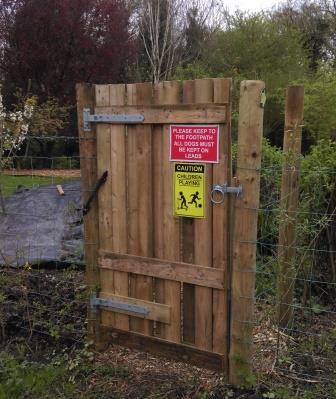
You then come out onto a lane – go left and you will readily see a new gate in front of you. This property has recently been renovated and the footpath improved. You are crossing private residential land, so please observe and adhere to the signs requesting dogs to be kept on leads. When you come to a gravel drive go right and almost immediately left - there is a sign indicating the footpath. |
 |
|
|
Now you come down into the first crossing of Tun Brook – over a charming footbridge. This is a lovely little wooded glade and remarkable for being right on the edge of the village, but not known to many! |
|
|
| Coming out of the valley you cross a stile and then come to a gate. This view has changed in the past 10 years, with the building of the impressive and beautiful Salisbury House. Head straight across the field to the gate in the corner ahead of you - there's a small gate through on to Elston Lane. Turn right. | 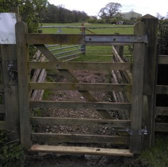 |
|
|
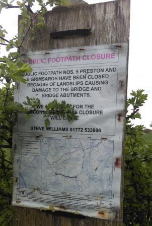
You continue down Elston Lane a short while. This is where the route has had to be significantly shortened. A little way past Chapel House, you will see a footpath sign to the right and also a notice, explaining that the route has been altered. Cross into the field and walk perpendicular to the road, through an opening, then keeping the hedge to your left. |
 |
|
|
Cross the stile and you will again drop down into Tunbrook Valley. All this section of Red Scar and Tunbrook Woods is designated a SSSI - Site of Special Scientific Interest. This is because of particular woodland species and some nationally scarce butterfly species. |
 |
|
|
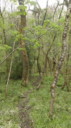
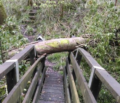
There are two charming footbridges that carry the path across a small stream and Tun Brook - itself barely more than a stream. Unfortunately - as shown in the photo - on the day we did the walk there had recently been a tree-fall - which had damaged the second footbridge and gave an interesting obstacle to overcome - crawling under it is the only, though not terribly difficult solution. It is a steep scramble to the top of the valley - take time to stop and listen for woodpeckers..... |
 |
|
|
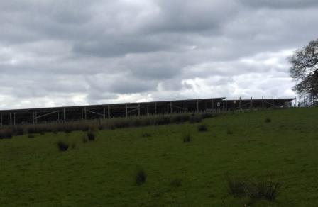
When you reach the top of the valley, cross the stile and you will see the edge of the newly built solar farm at the top of the slope. Head towards the right of this and keep the solar installation on your left. You will reach a shale track with a gate in the opposite side - cross through that and continue along the edge of the solar farm. |
 |
|
|
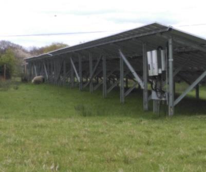
For some this will be a fascinating opportunity to get up close to and inspect such an installation. For some it will appear as an ugly eyesore on the landscape. In any case it is producing an impressive quantity of electricity to power our homes and businesses. You may spy some of the sheep happily grazing among the rows of solar panels! |
 |
|
|
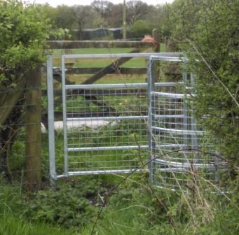
Once at the end of the solar installation, keep straight ahead, keeping the hedge to your right. You'll cross another small stile and then feel like you're heading into a dead-end corner until you spot this shiny new kissing gate tucked into the corner of the field. Go through it and turn left. A short distance along the lane there is another kissing gate to the right, go through that and cross the field, keeping the hedge to your right. You will then cross on to a cinder track - turn right and head along the side of the industrial estate on to Longridge Road. Turn right and you're heading back into Grimsargh. |
 |
